Menu
Official home of the Lincoln County Authority of Tourism (LCAT)
Menu
Menu

White River Narrows
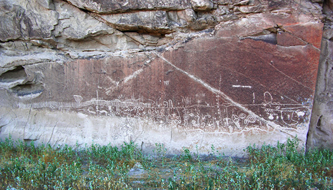
White River Narrows Archaeological District was placed on the National Register of Historic Places in 1976. The area is outstanding not only for rock art but also for the impressive rhyolite cliffs. The District is located entirely on lands administered by the Ely District Bureau of Land Management. When exploring the White River Narrows, be sure to watch your step. Rattlesnakes are common in this area.

Site Information

White River Narrows Archaeological District was placed on the National Register of Historic Places in 1976. The area is outstanding not only for rock art but also for the impressive rhyolite cliffs. The District is located entirely on lands administered by the Ely District Bureau of Land Management. When exploring the White River Narrows, be sure to watch your step. Rattlesnakes are common in this area.
Directions — White River Narrows Archaeological District
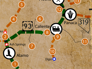
The entrance (dirt road) to White River Narrows Archaeological District is 23.0 miles from the intersection of State Route 375, State Route 318 and U.S. Route 93 (the “Y”). Traveling north on State Route 318 towards Ely, it is 4.1 miles past the “White River Narrows Archaeological District” sign and is on the right (east) side of the road. Traveling south from Ely, it is approximately 90 miles and is on the left (east) side of the road. A yellow BLM marker is just to the right of the dirt road. Go through the gate and continue 2.15 miles to the register.
Subscribe to the Mailing List!
Maps